


September 1, 2026
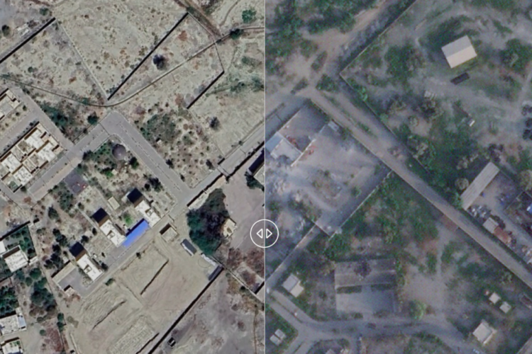
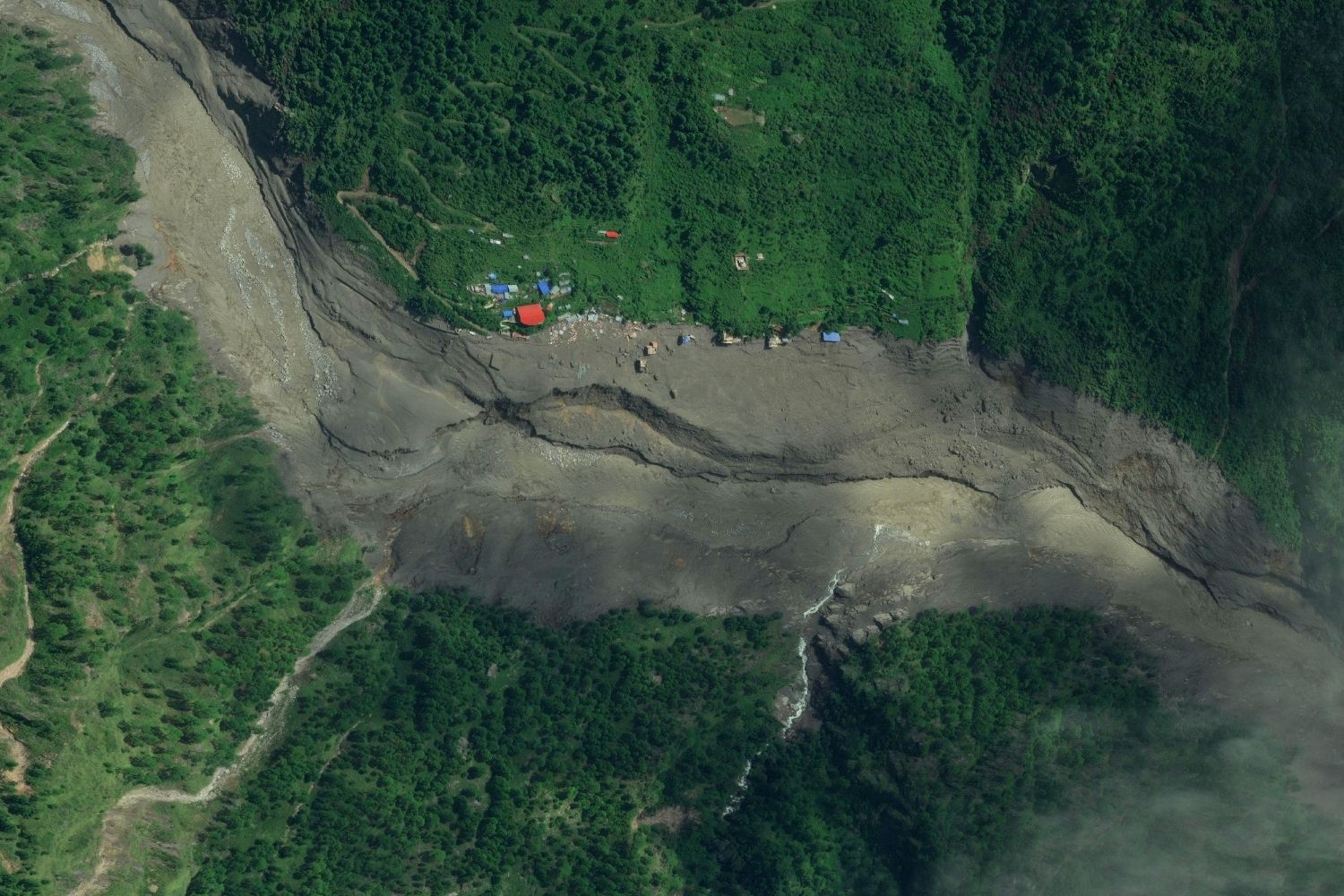
These two images, taken on January 2 and August 28, 2026, show the Trishuli River as it flows through Rasuwa District in Bagmati Province, before and after the devastating flood that swept through large areas of northern and central Nepal.
More than 1000 bodies have been recovered, and nearly 4,000 people remain missing, according to data from the Nepalese disaster management authority as of September 1. Rescue teams have brought more than 11,800 people to safety and continue to work to locate those still trapped under the rubble.
On the morning of August 26, part of a glacier in the Lāṅṭāṇ National Park in the Himalayas near the border with Tibet, broke away from the mountain along with the bedrock beneath it. The mass of ice and rock fell more than 1,000 meters, triggering a seismic signal equivalent to a 5.2-magnitude earthquake.
It is yet to be established whether the initial slope failure was a landslide incorporating part of a glacier or a glacial collapse, according to the United States Geological Survey.
The massive avalanche of ice and debris reached the bed of the Lende Kholā River—which feeds into the Trishuli River—and created a dam, which, when it broke, unleashed a massive wave downstream. Several populated areas in various districts along the river were devastated, including the Rasuwāgaḍhī border post between Tibet and Nepal.
In the before-and-after images above, the village of Thuman can be seen submerged by the floodwaters.
CREDITS:
JANUARY: Google Earth 2026
AUGUST: Satellite image ㉢ 2026 Vantor