October 28, 2025
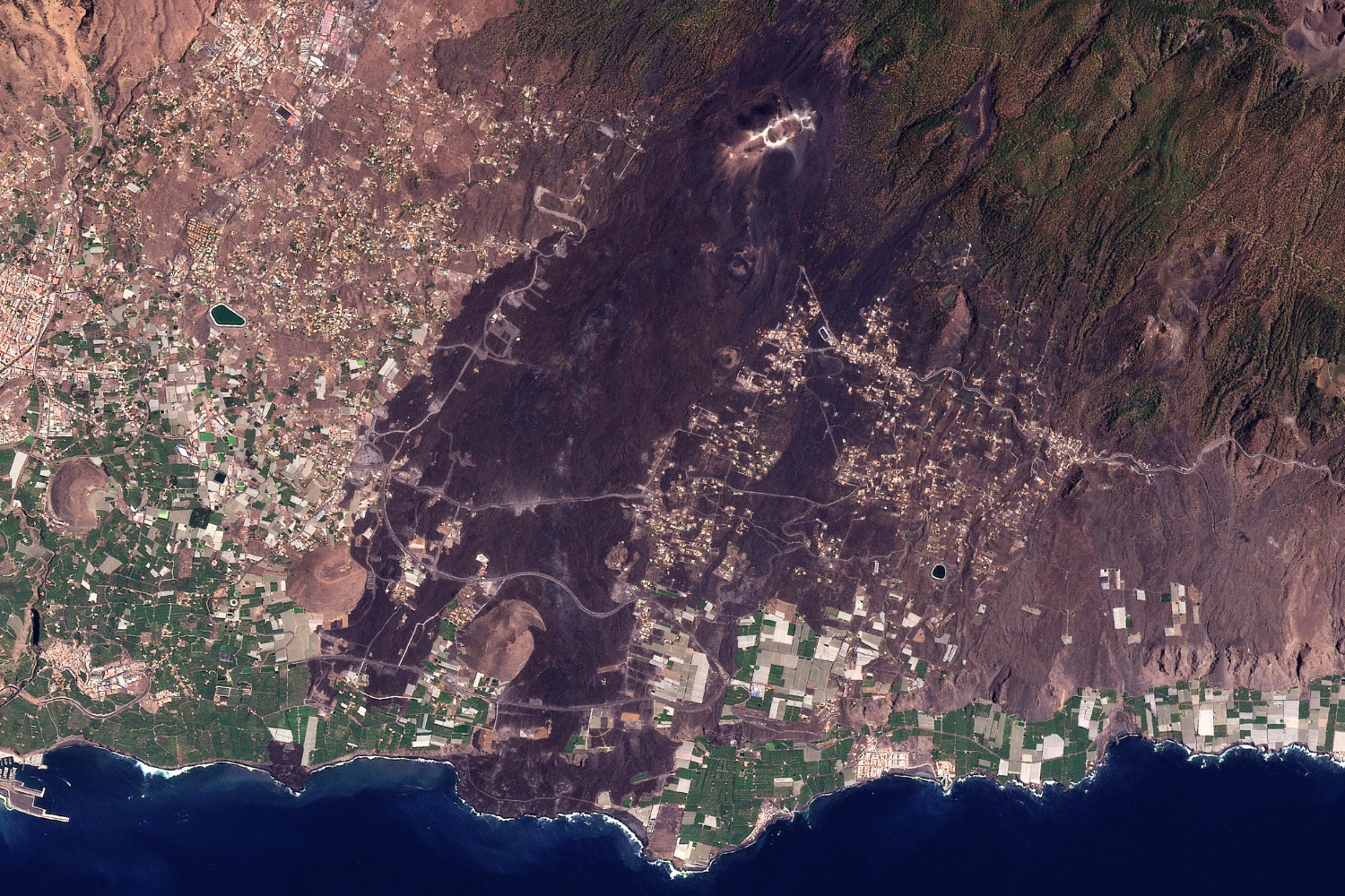
These two satellite images, taken on September 10, 2021 and September 28, 2025, show the Aridane Valley area in western La Palma, Canary Islands, before and after the most destructive eruption in the island’s history.
On September 19, 2021 a volcano located within the El Cumbre Vieja mountain range began an eruption that would last 85 days until December 13, 2021. About 5,500 people were evacuated with no injuries reported.
Scientists from the Canary Islands Volcanological Institute (INVOLCAN) determined the average speed of the lava’s flow was 700 m/hour with temperatures around 1,075°C at the start of the eruption. The size of the lava field extended an estimated 12 km2 with a depth of up to tens of meters at some points according to INVOLCAN. Buried under the lava lies 1,345 houses, 370 hectares of cultivated land and 73.8 kilometres of roads.
The lava river not only flowed through the land but it extended 47 hectares into the ocean creating new territory known as a “fajana”. If you look at the bottom centre left of the image you can see the fajana as it is today.
Credits:
Planet Labs.
Map: