March 9, 2026
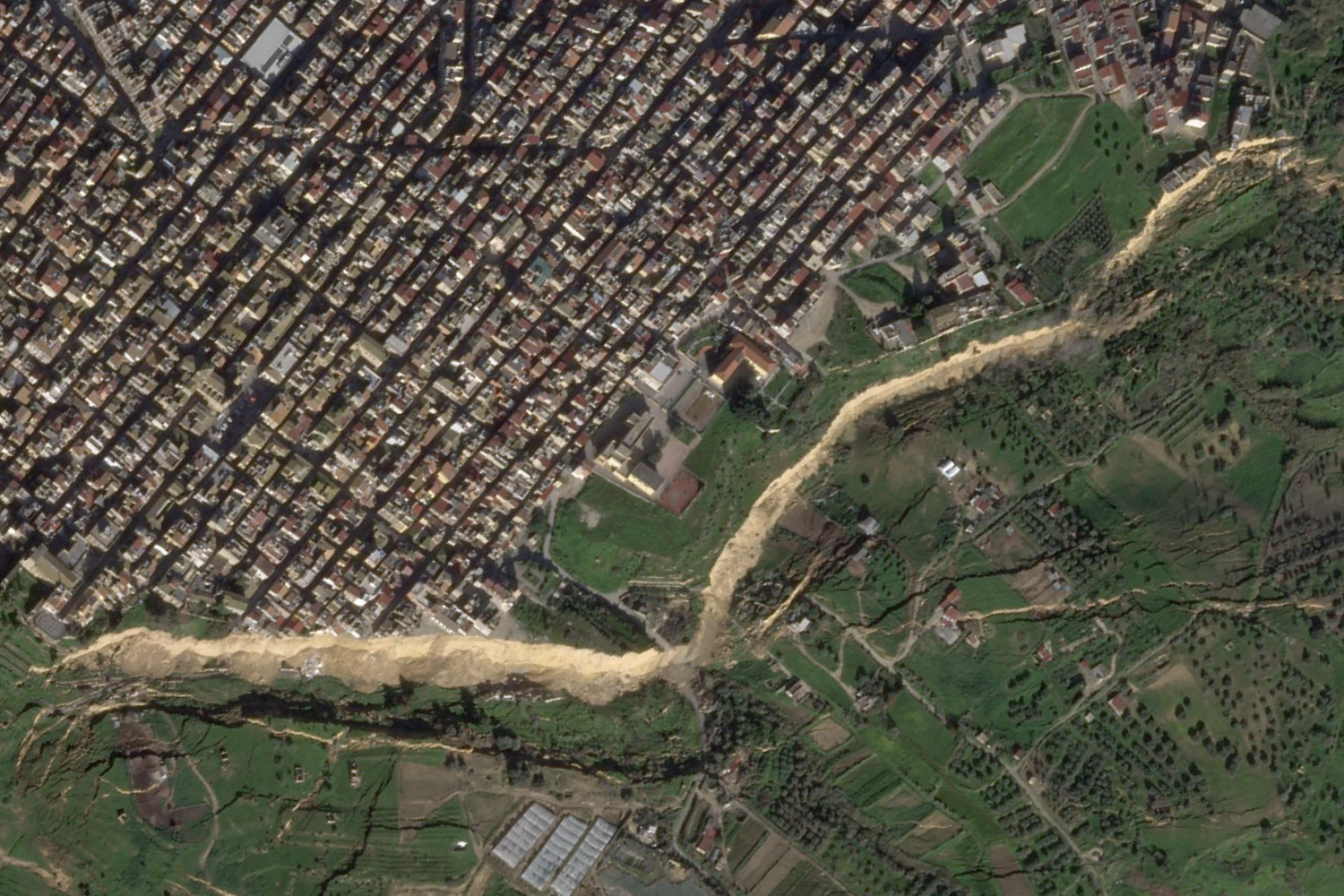
These two satellite images captured on January 30, 2025 and January 27, 2026 show the aftermath of a major landslide that shaved off part of the town of Niscemi, in the province of Caltanissetta, Sicily on January 25 2026.
Heavy rains from Cyclone Harry battered the Mediterranean in the third week of January causing widespread flash flooding and damage across Italy’s southern regions of Calabria, Sicily, and Sardinia prompting a state of emergency to be declared.
The severe weather triggered two landslides in the town of Niscemi, home to some 25,000 people, reactivating faultlines and causing extensive damage.
About 1500 people were evacuated during the landslide as cars and infrastructure were pulled 25 to 50 metres down the slope, according to the Civil Defence Department. A gaping and unstable cliff edge stretching close to 5km has been left along Niscemi’s historic town border.
This is not the first time that Niscemi has suffered this phenomenon. On October 12, 1997, approximately 1.5 square kilometers of land shifted causing multiple public and private buildings to be destroyed or declared uninhabitable.
The European Federation of Geologists has called for greater unity in landslide risk management in the wake of the Niscemi event. They say landslides, debris flows, and slope failures —rapid currents of mud, water, rock, and sediment that carry other materials in their path— are becoming more frequent and severe with climate change.
Credits:
2025: Esri, DigitalGlobe, GeoEye, i-cubed, USDA FSA, USGS, AEX, Getmapping, Aerogrid, IGN, IGP, swisstopo, and the GIS User Community
2026: Planet Labs.