March 10, 2026
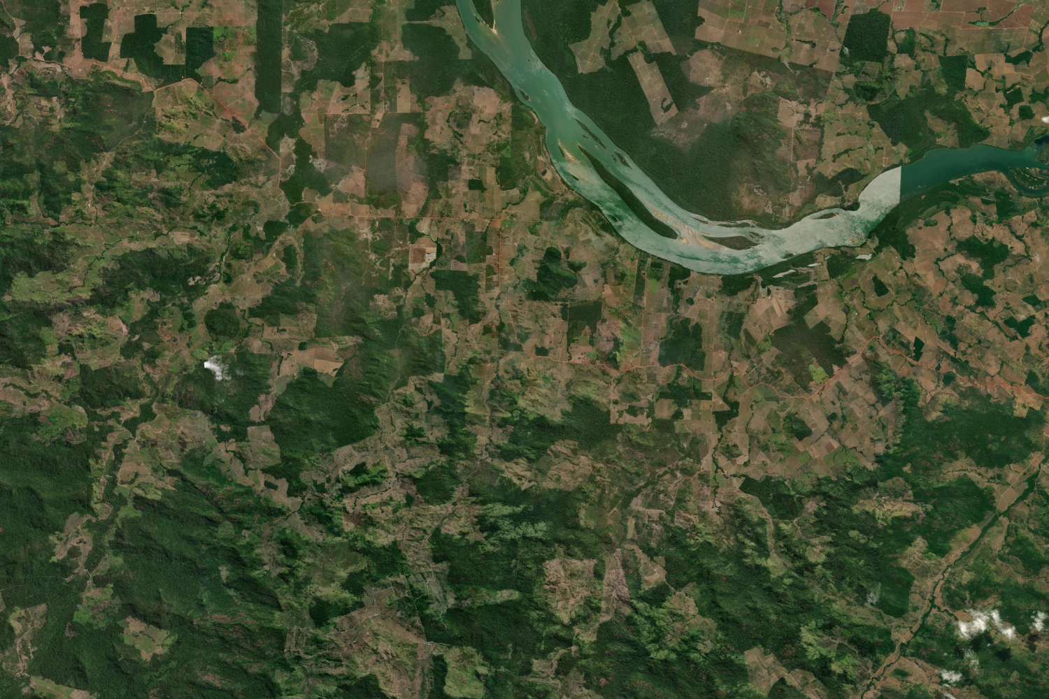
These two satellite images, captured on May 6, 1995, and February 27, 2025 show the stark effect of 30 years of deforestation in the municipality of São Félix do Xingu, in Brazil’s Pará state.
Between 1995 and 2024 an accumulated area of close to approximately 2 million hectares of forest was classified as lost to deforestation in São Félix do Xingu. The municipality was losing over 1000 km² of forest annually in the early 2000s before government policies and social attitudes towards environmental conservation shifted. São Félix do Xingu is reported to be the municipality with the largest loss of tree cover in Brazil, according to Global Forest Watch. It was also found to be the largest emitter in Brazil, with 29.7 million gross tons of CO2 recorded in 2018.
The key drivers of the large-scale land clearing have historically been the creation of pastures for agriculture and livestock business as well as mining, logging and wildfires. In 2024 the area suffered extreme wildfires losing 300 kilotons of tree cover.
The United Nations Climate Change Conference COP30 was held north of São Félix, in the state capital of Pará, Belém, in November 2025. Protesters stormed the event to demand greater inclusion of indigenous groups in the conference and urgent measures to protect the Amazon and end fossil fuel exploration.
Credits:
1995: Landsat 4-5 USGS
2025: Esri, DigitalGlobe, GeoEye, i-cubed, USDA FSA, USGS, AEX, Getmapping, Aerogrid, IGN, IGP, swisstopo, and the GIS User Community