March 10, 2026
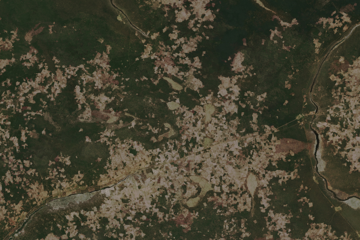
These two satellite images taken on November 22, 2002 and November 16, 2025 show the tree losses in the city of Menongue, in the Cubango Province, in southeastern Angola in the 23 years since the country’s Civil War ended.
Africa has the highest rate of forest loss in the world, and with evidence of accelerating rates of deforestation across Sub Saharan Africa, climate experts are concerned.
The forests of Angola, which are made up primarily of Miombo woodlands, were abandoned in the rural exodus ignited by the 27 year civil war that started in 1975 and ended in 2002. As Angolans moved back into former conflict zones post-war, they began utilising the forest spaces again as can be seen through satellite imagery documenting the Menounge area.
Deforestation is largely driven by agricultural expansion, logging, fires and charcoal burning.
In addition to causing environmental problems such as soil erosion and resource depletion, global deforestation exacerbates climate change: it is estimated to account for between 12% and 20% of global greenhouse gas emissions.
Credits:
2002 – Landsat 7
2025 – Copernicus