March 9, 2026
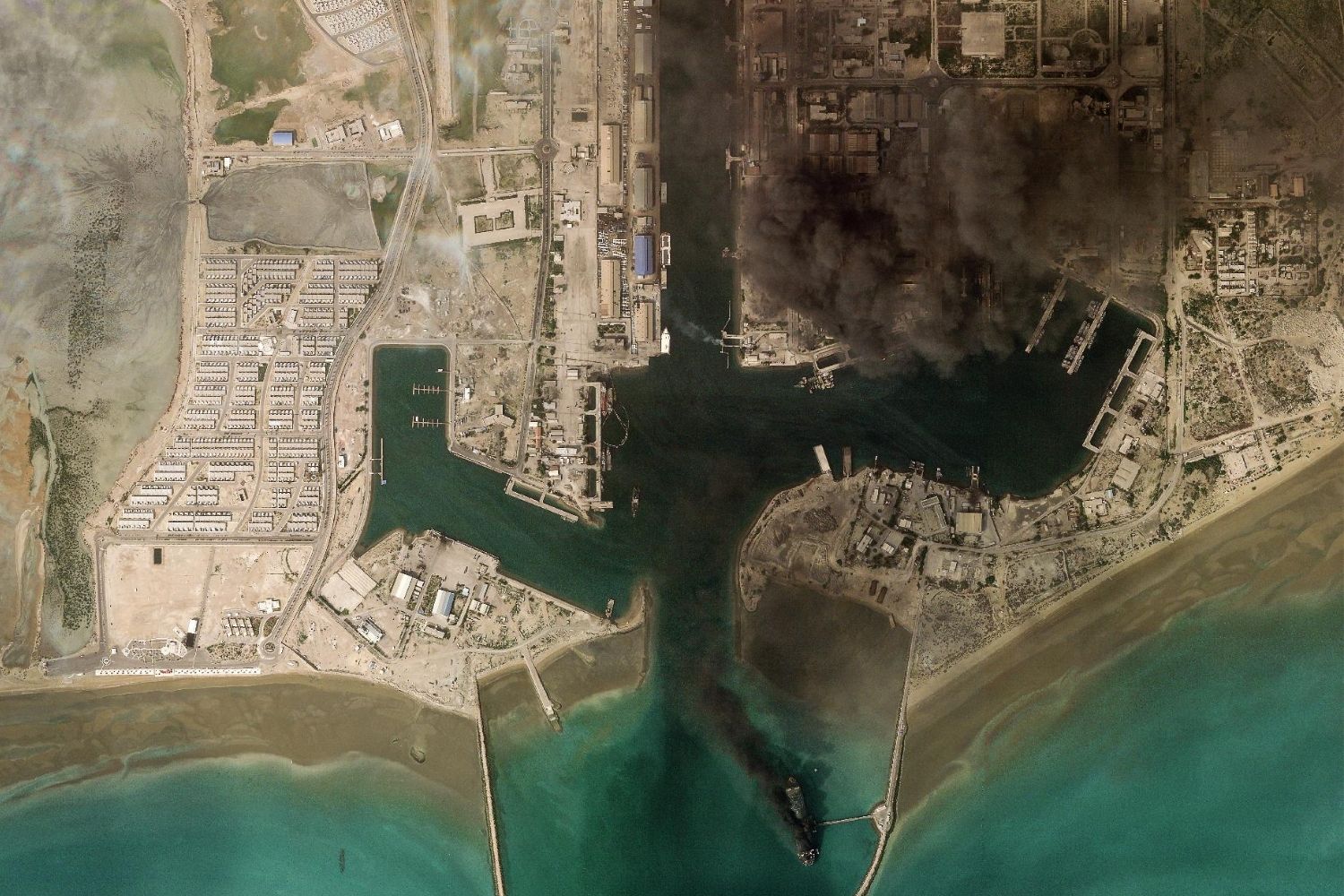
These two satellite images, captured on 29 May 2025 and 2 March 2026, show before and after an attack on the Bandar Abbas naval port, in the province of Hormozgan in southern Iran, situated on the Strait of Hormuz.
Various warships were destroyed and damaged in the attack on Iran’s main naval headquarters on the second day of the joint US-Israeli offensive against the country, which began on 28 February.
The latest satellite images supplied by Planet Labs show what appears to be Iran’s 750-foot warship the Makran, among the damaged fleet at the Bandar Abbas base. The Makran, a converted crude oil tanker, was one of Iran’s largest military ships.
The Bandar Abbas naval base is strategically located on the Strait of Hormuz between the Persian Gulf and the Gulf of Oman. The Strait is a key export route for the major oil-producing states in the Gulf: it is estimated that 32% of the oil and 20% of the liquefied natural gas transported by sea worldwide passes through here. Since the start of the attack on Iran, the Islamic Revolutionary Guard Corps has blocked this strategic strait and warned it would open fire on any ships attempting to pass through. A number of vessels have reported incidents of sustained damage from unknown projectiles according to the maritime security body United Kingdom Maritime Trade Operations.
Marine traffic in the Gulf of Persia and the Gulf of Oman remains stalled with hundreds of ships anchored in or near the Strait waiting for safe transit according to vessel tracking. The International Transport Workers’ Federation has designated the Strait of Hormuz and surrounding waters as a High Risk Area.
Credits:
2025: Esri, DigitalGlobe, GeoEye, i-cubed, USDA FSA, USGS, AEX, Getmapping, Aerogrid, IGN, IGP, swisstopo, and the GIS User Community
2026: Planet Labs.