February 4, 2025
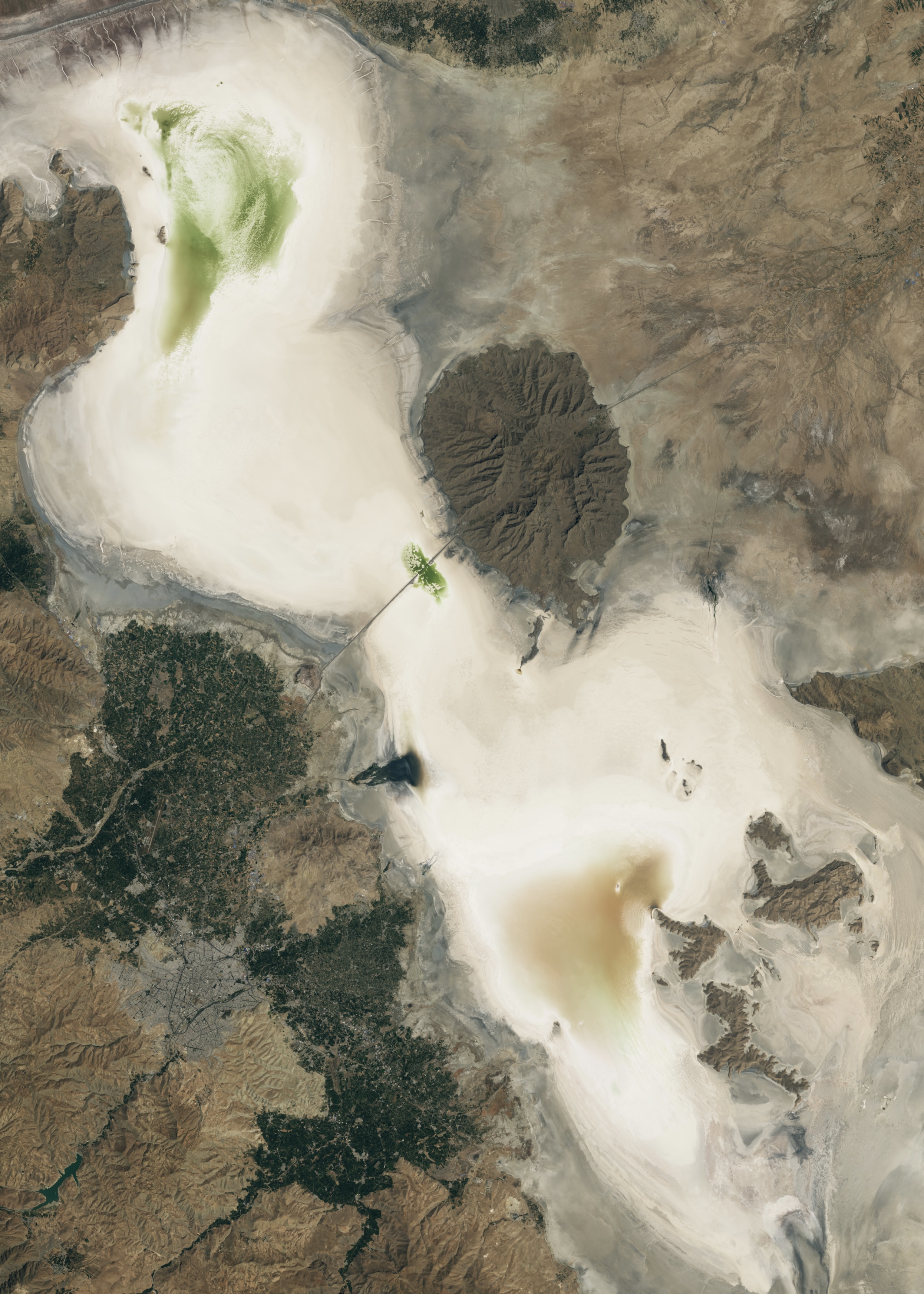
These two images taken by Landsat imagery on August 25, 1998 and September 7, 2023 show the severe shrinking of Lake Urmia, in the West Azerbaijan Province of north west Iran.
The largest lake in the Middle East and one of the largest saltwater lakes on earth, Lake Urmia at its greatest extent, once covered a surface area of 5,000 square kilometers. The Lake’s ecosystem was relied upon by a host of animal, plant and microbial species as well as the regional economy and the national tourism industry. It has been recognised as a UNESCO Biosphere Reserve and a Ramsar protected wetland site due to its importance, however, consecutive droughts, mismanagement of ground water resources and the construction of dams and reservoirs along the 60 tributaries that feed into the lake, have reduced 95% of its volume over the last two decades.
With its future at risk a restoration plan was developed by Iran’s government in 2013 entailing multiple measures including water transfers, efficiency regulations and controls on agricultural usage and extraction. The lake’s surface was last measured in November 2024 at 850 square kilometers, or 17% of its historic potential, according to figures from the Sharif University Lake Urmia Research Project.
1998: August 25, 1998, the Landsat 5 satellite. Source: Nasa Earth Observatory
2023: September 7, 2023, the OLI-2 (Operational Land Imager-2) on Landsat 9. Source: Nasa Earth Observatory